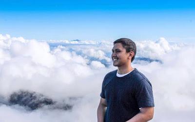
Mt. Pulag, Benguet
If you are a regular climber or hiker here in the Philippines, one of the ultimate goals is to experience trekking at Mt. Pulag. The peak of this mountain is so popular that even beginners have heard of it. Since I started climbing last October of 2017, that goal grew on me too that I was so up for it that if any of my friends would have the schedule to climb it, I have to make sure to tag along.What makes Mt. Pulag popular? The temperature up there. Since the Philippines is a tropical country, most Filipinos only experience extreme natural cold weathers on other countries like Japan, Korea and the US. Only a few spots here in the Philippines got "it" and one of them is Baguio City (which you need to pass by in order to reach Mt. Pulag). Well, it doesn't snow in Baguio nor in Mt. Pulag but during cold seasons like from December to February, frost can be seen in plants and small areas of water. I would like to see it first-hand. I just cannot imagine that there is a place in the Philippines (which is like an oven for me - just exaggerating though) can be as cold as that.
Not that long, my badminton friends got an October 2018 hike schedule. It's not the "perfect" season to go up there but since I don't know when will be the next possible one (if there will be), "Let's just do this". We have our group named "Day hike", since we are all employed people, we usually need to go to work the following day after any activities we do, but for this one, we have allot 2 days and 1 night [starting from going there early morning of day 1 until reaching back to manila on the second night which is not included in the count].

Day hike members without Patrick
One of the big hindrances most people face on its pre-climbing requirements is the medical certificate. I actually don't know if there is any other mountain here in the country that requires it too but we did got ourselves each. Authorities there had previous experiences, hikers that needed medical attention because they cannot withstand the cold weather thus requiring the "Fit to Climb" certificate on all climbers after that.So we started our adventure by meeting up at Cubao, Quezon City with our climb coordinator Ken who also rented the van for us. There were 12 or 13 of us inside with Kuya Eus, Ate Laura, Eric, Van, Maggie, and Luis. We took the Marcos highway route since Kennon road was closed that time. If I am not mistaken, some landslide(s) happened due to the bad weather they recently had there. There was I think even a typhoon that passed by the area before our trip. I still remember this because the driver's skills was pretty awesome! Lets just say that he has been doing it for quite a while now. There were edges near the jump-off station that was nerve wracking, one miscalculation can lead our van to fall on a number of steep and narrow areas we need to go through.
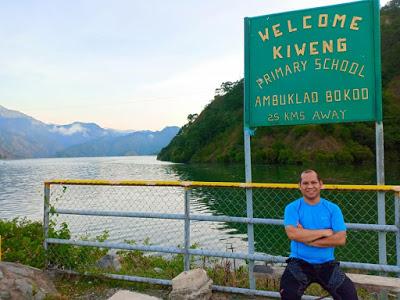
Eric at Ambuklao Dam
But before that, we dropped by a dam to break the long ride. It was time for us to stretch our legs and move a bit since we were sitting for hours already. By the time we got off the van, we were surprised with the cold weather. Most of us were not ready for it yet that we were shivering while walking. As far as I can remember, we were all wearing thin clothes that time which I don't know why (lol). But moving on, the view there was good. It was refreshing to be in a high place, with mountains around, a body of water present, flock of birds flying, fog moving on the side, all at the same time with the cold weather. We are indeed away from the city. I felt like breathing a cleaner air that purifies my lungs replacing the polluted city air inside me. I know you know this feeling too so no more explanations needed hehe. If hindi ka maka relate, try mo umuwi ng probinsya o kaya naman lumayo sa syudad, para maiba naman. Ganun!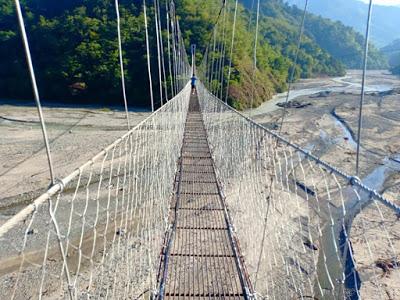
Jang Jang Hanging bridge at Ambuklao, Bokod
we had our breakfast at "Jang Jang Eatery". It was filled with the other hikers too that a long line was already present even before we can order food. Ken recommended that place and the group was hungry so its like having no choice at all but to wait it up. The bad news is that when it was our turn to order, some of the dishes were already sold-out. The group ended up eating anything that was still available while I decided to eat junk food, yes, for breakfast (lol). The hanging bridge was just located at the back of it so we pursued on checking out the area. I found the place super nice, worthy of Instagram photos because it had wide open spaces and some interesting combinations of nature. The hanging bridge looks very low from a far but when we where traversing it already, we were like "wait, its reaaaally high!" Haha! What makes it scarier were the big gaps in between the steps.. Your phone can literally fit right in there and it was a long walk to the other side of it.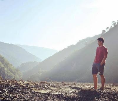
Below the Ambuklao bridge
The view below was just as beautiful as from the top in its own way. It was artistically dramatic that you can capture different moments there depending on how you wanted it to be. You can capture the water flowing on the dry lands, take a picture of the bridge connecting the mountains, seize the moment of the sun rising from the scenic horizon, or this wasteland-like "photography art" we did there. So much potential, really. I felt like we can already end the day with the photos we had there Haha! I actually forgot that I only ate junk food for breakfast. It was that good.So after here, we continued our journey and had a stop in one of the areas on the way to check our medical certificates. We will be submitting them once we arrive at the DENR (Department of Environment and Natural Resources) office where all the orientations happen.
But even before that, we had a surprising detour to Daclan sulfur spring. Well, surprising in a way that before the trip they just told us that there will be some detours on the way.. It was not my first time seeing sulfur in action but viewing it organically (haha!) or raw in nature (if this translation helps) makes me value it more. It is like boiling mud-ish water.. And it literally smells man-fart that ate eggs for breakfast. What magnifies the whole thing was its size. It is quite scary in person thinking of the possibilities that may happen like randomly bursting while we were there or accidentally someone falling in the pit (Semi-brutal lol), I wonder how deep was it though. By the way, this is just the biggest pit in the area, the whole thing was huge. There were many pits scattered around boiling and dripping sulfur on the ground.
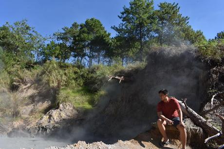
Daclan sulfur spring
Not that far from there is where the office of the DENR is located. It is where all hikers are oriented to the do's and don'ts on climbing Mt, Pulag. Don't worry, it is but far enough from the sulfur spring's odor to not reach your nostrils. The orientation was short but since the room was limited, it happened batch per batch. Mt. Pulag has a number of peaks so groups will be assigned to take different routes to avoid crowding a specific area at the same time. Your group can still decide to go to the other peaks as long as you follow first the initial route at the given time. So after a number of waiting games and a grueling road trip.. we arrived at our home-stay area which is commonly called the "Ranger Station". It is where all the camping sites are located thus being set as the jump-off area.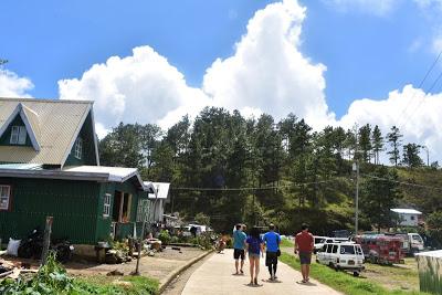
Babadak Ranger Station
We were blessed actually to have home-stays already that was included in our package said Luis as few months back, there were still none of them available thus forcing them to camp literally.The place was awesome, it was "Baguio feels" but with so much more offering. All natives there had rosy cheeks, there were many fields there filled with crops, the weather was colder especially at night time, and what struck me was the fact that we were in a village-like area which had a view that we were actually over some of the clouds already. AND! We haven't even started hiking yet. Man, how high can we still go once we reach the peak.. how cool is that? So excitement started building up for tomorrow's venture.
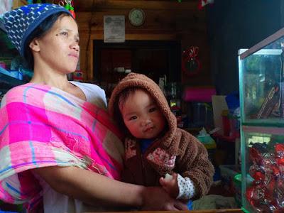
Store owner with her baby below our home-stay
Aside from settling down at our home-stay and got our things ready for tomorrow's hike, we also got the spare time to walk around the station. It was an opportunity for us to familiarize the area if anything happens especially for emergencies. But there is one thing that I am really thankful for, and that is having this convenient store located just below our rooms. Come on, you just have to appreciate that. The store owner even had a super cute baby that we flocked with every time we pass by trying to win who will get his/her attention (Van, do you still remember the name? Haha - comment down below).Knowing our early hike tomorrow, we ended day 1 sleeping after our early dinner. By the way, they serve unlimited rice there (was it brown or red? Eric, comment down below lol) which was super awesome. They really know how to take care of the hiker eh?
So as day 2 begins, as usual, the group is on time (I am really impressed how professional the group is haha!) as we set to start climbing Mt. Pulag. Goals! Eric recorded the temperature which is at 64 Fahrenheit or 18 degrees Celsius.
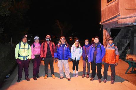
Start of Mt. Pulag hike at Babadak Ranger Station
As we go through the starting trail, I just can't help but look at the sky. It was my first time seeing so many (as in a lot) clear stars up there. It came to a point that I nearly slipped one time because I was not looking on the trail. I even shared this thought to Eric and Kuya Eus that if we only have the camera that can get this view? I think the picture will go viral (I am dead serious about this).
Stated from the orientation, hiking Mt. Pulag has 3 layers of surroundings.. The first or base layer is the pine forest which is the common view there, Second layer is the mossy forest where the trees are now starting to be covered with moss (getting higher further up from the base camp), and lastly the grassland, which is the top most layer, if you cannot see trees around you anymore you are nearing the peaks. So with these basic details, at least it gives you an idea on how further you already are.
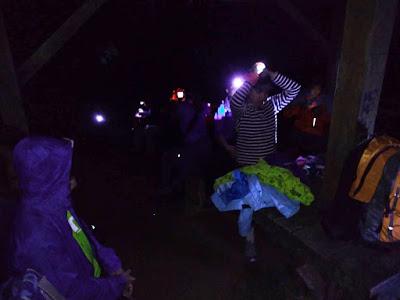
Ranger's house near the lowest peak
Don't forget to bring your lights as you will be trekking in the dark. I remember bringing a small flashlight here running out of battery, good thing I am with some ever-ready friends hiking with me like Kuya Eus having a spare flashlight and Maggie who serves as the the group's lady refrigerator.The hike is really long so be ready with your stamina and don't skip leg day if you are working out. Though considered as a beginner's hike, make sure to be ready mentally as well. I suggest you bring friends who pushes you enough to get things done so you can encourage one another to finish it. To be honest, I got a hard time reaching the summit of Mt. Pulag even though I had previous climbs already but credits to our group who had no excuses or whatsoever to not reach the top. Haven't heard a single complain, or may be I just can't remember? Haha!
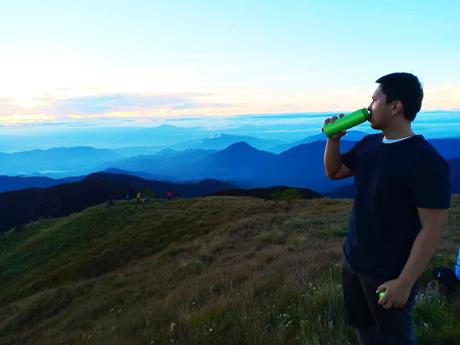
Sipping coffee, tower site at Mt. Pulag
One of my favorite spots there is where the photo above was taken, the tower site. There is really a tower behind me hence where the name came from. This location is the best suggested place if sea of clouds is present. In here also as from what I experienced was the coldest temperature we got which is 52 Fahrenheit or 11 degrees Celsius. It was really cold. I think it was even lower because the wind was blowing non stop. I took my jacket and gloves off to take photos using my phone but not that long I needed to suit it all up again because my hands were getting frozen.
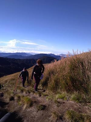
Kuya Eus & Ate Laura Trekking to Mt. Pulag's summit
At this point, I already considered our trip successful because now I do believe that such a cold place can really be located within the borders of the Philippines. Haha! At this point also, I was ready to go back if the majority decides it. But not our group (yes naman!).We continued to trail the grasslands and it took almost another hour from here to reach the summit. "Near yet so Far". This is literally a perfect description for this part of the trek. There will be some areas where you can already see the highest point but you will be tricked by how close it looks. In reality, you still need to go around like 3 more hills before you reach the foot of the final stretch. And from its foot, a steep upward climb is still waiting before you reach the Mt. Pulag signage. That specific part is where my breathe nearly left me haha!
Do take note that when you reach the grassland part, not a single tree can be seen and the temperature starts to go high. So you will be like going into a fight naked under the scorching sun and have no choice but to either move further or go back after going through a freezing area. You will be asking yourselves, "Why are we doing this again?". So after a few fights, brawls, and some dramas (just kidding), we conquered Mt. Pulag by reaching it's summit! Congratulations guys!!! Woohooo!! Ticking it off the bucket list. We can stop hiking now and stop continue fooling ourselves on climbing again Haha!
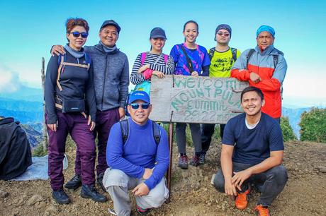
Day hike group conquering Mt. Pulag - Highest Peak (Summit)
But in climbing life, after a hardship is another even harder whatever ship it is lol. Going down and trailing back to the jump-off point. But before we did, what a time to have an opportunity to be up-close in person with some clouds that got near us while on the summit.
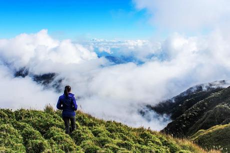
Vanessa staring at the clouds near the summit of Mt. Pulag
More amazing shots can be seen on the video below so make sure to play it. So as we climb down the mountain, we made sure to get photos of the great spots we skipped earlier in the morning since it was still dark. One of those is the mossy forest which is the photo below.
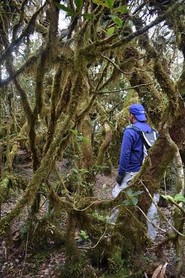
Eric at mossy forest from Mt. Pulag summit
Still amazed by it since most of the movies I like have mossy forest scenes in them like "The Lord of the Rings", "Anaconda", and lets put "Jurassic Park" in there haha! Seeing places such as these which are perfect for movie sets put an extra dart in the heart and makes me appreciate them more. Well, it is all God 's creation so "Ikaw na talaga Lord!And as our usual conversations that we have on going down a mountain, can you guess what the topic is? Of course you do, FOOD! Well, if you read the first part of this blog post, you know that we won't have any issues regarding that.
Cutting the story short, it was an ULTRA relief getting back to our home-stay alive with both legs attached to our bodies! That there were no casualties or even any minor incident that happened. The whole journey sailed smoothly, great job to everyone. And as we bid our farewell to our home-stay and Mt. Pulag, we asked each other "Ano? Babalik pa?" I will hang those questions and let you guys guess if we wanted it still? One thing is for sure though, that we were grateful for this opportunity.
Here is the video of our Mt. Pulag adventure

